GPS vs GNSS: we compare satellite mapping technologies and explain the science behind them
What is GPS? And how’s it different to GNSS? We give you the lowdown on the tech that powers your bike computer and smartwatch


GPS vs GNSS: you probably use the initials of at least one of them on a daily basis, but do you know what they mean? Is there a difference? And does it matter when you're using your bike computer or smartwatch?
While most of us now take using technology to record a bike ride for granted, there's some extremely clever science helping our devices know where we are, where we want to get to and how long it will take us to get there – and that science is changing and improving every day.
All the best cycling computers and best smartwatches for cycling use global satellite systems to pinpoint our location, but whilst we routinely describe the tech as GPS, it is GNSS that's actually the correct naming convention.
But what is GPS? Who operates the system? Is it better than GNSS? And how does all this satellite magic work anyway? Read on to get a crash course in satellite navigation in this expert GPS vs GNSS guide.
GPS vs GNSS: what’s the difference?
What is GPS? “GPS stands for ‘Global Positioning System’’ and is the name for just one of the many satellite operating systems that criss-cross the earth's orbit,” says Rich Robinson, head of UK product at Garmin. “It’s owned and operated by the very cool-sounding United States Space Force.”
That’s GPS sorted. So what is GNSS? ”GNSS, or ‘Global Navigation Satellite System’, is the generic term that describes all of the satellite systems that are owned by nations and governing bodies across the globe.
"I always think of the 'Hoover' analogy when describing GPS and GNSS,” he adds. “Hoover became synonymous with vacuum cleaners as one of the original brands. The same with GPS. It was the first global navigation satellite systems, but now it’s one of a handful of systems in operation.”
Get The Leadout Newsletter
The latest race content, interviews, features, reviews and expert buying guides, direct to your inbox!
How does GNSS work on my bike computer and smartwatch?
Light travels at the incomprehensibly fast speed of 300,000 km/s (186,000 miles/s) –and so do the radio waves from a satellite.
While this seems instantaneous to human brains, there’s actually a time lag as information is sent from around 11,000 miles overhead. This time lag can be measured by your GPS/GNSS device.
In his book Zoom, author Bob Berman describes how this is factored in to calculating your exact position on the ground:
“A GPS satellite contains an automatic clock that send out time signals," he writes. “The receiver recognises that it's the wrong time. Wrong because the signal, travelling at light speed, required one-twentieth of a second to arrive.
"Your GPS, which knows the right time, instantly calculates how far the satellite must be for the signal to have been delayed for exactly that amount of time. It does this with three or four satellites and thus triangulates where your position must be. All by using the known speed of light.”
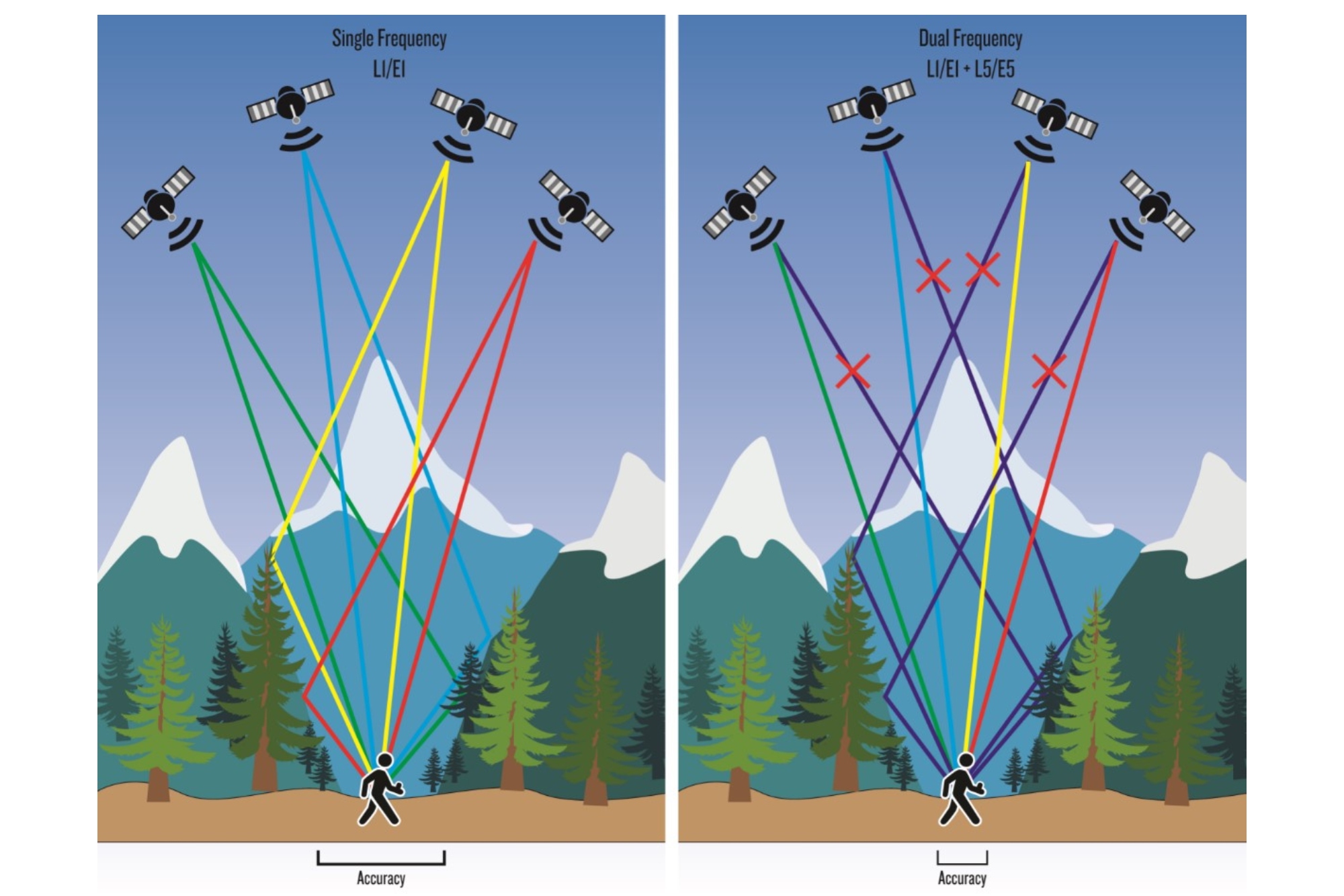
Dual frequency receivers are able to detect and ignore reflected satellite signals giving you better location accuracy.
Do GPS and other GNSS systems work the same way?
“Fundamentally, all satellite systems operate the same way,” says Dean Thomas, position, navigation and time consultant to the UK Space Agency. “It’s the number of satellites in operation and the number of frequencies that are different.”
“It's important to remember the basics when thinking about how a receiver, like a bike computer, works,” he adds. “Each satellite network uses different space planes and slots, depending on the number of satellites that make up the system, which is known as a constellation.
“Each GNSS use orbital planes surrounding Earth in the Medium Earth Orbit, this is because it's considered the best place for lots of factors, including getting the most coverage of earth for the fewest number of satellites.
"Take GPS. Its satellites are positioned in six equally-spaced planes, and each plane plane contains four 'slots' occupied by baseline satellites. This 24-slot arrangement ensures users can view at least four satellites from virtually any point on the planet.
"Some receivers, like your bike computers, will use a dual- or tri-[band] operating system, such as GPS, GLONASS and Galileo. This provides more accuracy than just GPS alone, especially in the more remote parts of the world, or where densely built up urban areas or tree cover can block or reflect a signal.
"Having dual frequency will make a big impact,” Thomas continues, “as it's where you get even more granular information, closer to that one-metre accuracy.
"Satellites transmit several different frequencies. There are military signals, which of course are restricted and closed, but consumer devices, like a bike computer, will, depending on satellites they are receiving from, use two, L1 and L5, frequencies. These will give you much better accuracy in positioning.
“It's currently only GPS that has the technology that will allow the dual-frequency system. Other GNSS will eventually operate on this dual-band system, but it will take a while for them to be replaced with that functionality.
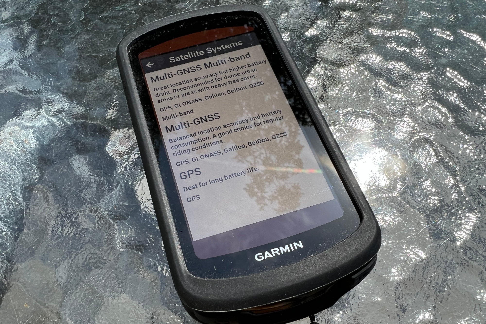
The Garmin Edge 1040 Solar is both both multi-band and multi-GNSS
“Tracking and mapping devices that can use both multi-band and multi-GNSS are significantly improved from ones that don't,” Thomas explains.
“Receivers that do both are able to detect and reject rogue signals. This means that in dense urban areas or where there is a lot of tree cover, the two frequencies working together have a much stronger chance of ensuring that you receive the correct information as to your location.”
"Although your accuracy of location will depend on the strength of your processor and mapping capabilities. This is why your mobile phone is one of the most accurate location detectors, as phone companies have been using the technology for a long time. It’s only now that other devices, such as bike computers, are catching up, as the technology becomes cheaper and more readily available.”

Which satellite system is which?
Who owns the GPS and GNSS satellite systems?
Declared operational in 1995, GPS is the name for the USA’s state-owned satellites and is committed to maintaining at least 24 operational satellites 95 percent of the time. In order to deliver this, the US Space Force has been flying 31 operational GPS satellites for over a decade. (According to the official GPS website, as of 26 June 2022, there are 26 operational satellites in the constellation – “not including decommissioned on-orbit spares”.
“In reality there are four satellite constellations that are used on a daily basis,” says Mark Bacon, head of space security at the UK Space Agency. "These are GPS, GLONASS, Galileo and BeiDou. Consumers can access these with their receiving device for free, and typically get an accurate geolocation pin of between one to three metres, depending on how many constellations and frequencies their device can process.”
There are several other global navigation satellite systems in operation, that you may have heard of. According to Bacon, however, most won't really be a factor when using your bike computer.
Here's a breakdown of the full global navigation satellite systems and who owns them:
- GPS (Global Positioning System): 26 satellites owned and operated by the US government
- BDS (BeiDou Navigation Satellite System): 35 satellites owned and operated by China (previously known as Compass)
- Galileo: 24+ satellites operated by the European Union
- GLONASS (Globalnaya Navigazionnaya Sputnikovaya Sistema): 24+ satellites owned and operated by the Russian Federation
- IRNSS / NavIC (Indian Regional Navigation Satellite System / Navigation India Constellation): Seven satellites owned and operated by the government of India.
- QZSS (Quasi-Zenith Satellite System): Four operational satellites, expanding to seven by 2023. Owned by the government of Japan, operated by QZS System Service Inc
"At the moment, most other constellations augment the three main ones,” says Bacon. “Some systems are still in their infancy, like QZSS, [which is] owned by the Japanese Government [and] is really a tag on to GPS. It has been positioned to specifically support dense urban cities in Japan, such as Tokyo, which can be really affected by the urban canyon issue". (An 'urban canyon' is a city street flanked by tall buildings, which can block satellite signal, just as a mountain might in a rural environment.)
“GPS is the most prevalent satellite system and can be ‘seen' by a receiver, such as your bike computer, smartwatch or smartphone almost anywhere in the world. But in theory you could have a bike computer that worked solely on GLONASS or Galileo satellites if you wanted, although people would probably still call it a GPS unit".
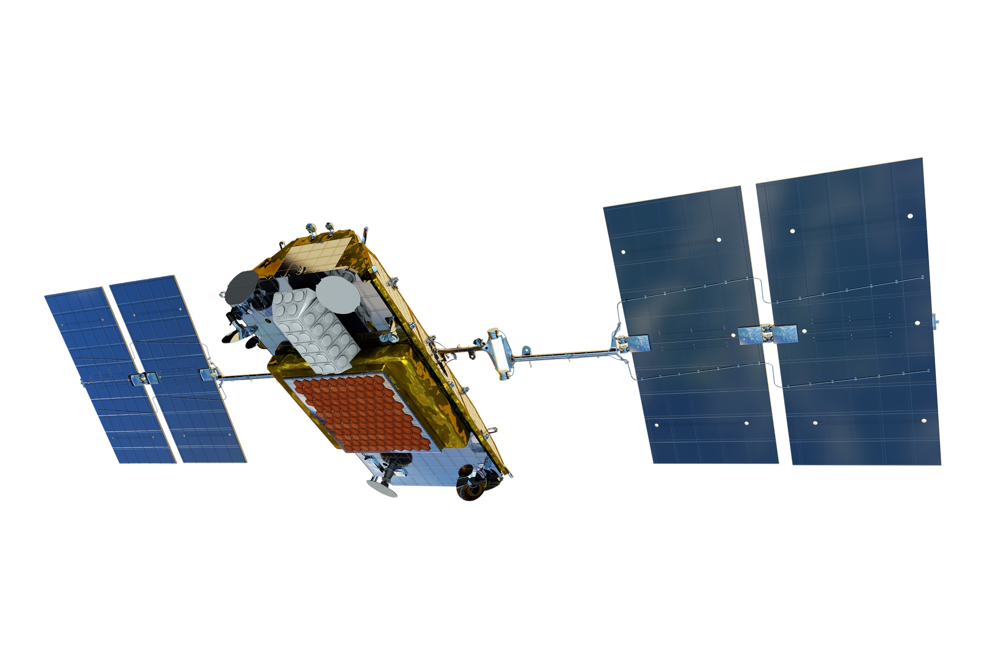
The Iridium satellite systems operates at a low earth orbit and allows for two way communication
Privately owned constellations
There are also now a significant, and ever increasing, number of privately owned satellite fleets. Some of these, such as the Iridium satellite network, offer users a more interactive service, with functions like third-person tracking, location sharing and two-way emergency SOS messaging without a phone signal – as well as satellite phones.
The key difference between government and privately owned satellite systems is that the former are freely available to all users worldwide to provide positioning, navigation and timing services globally. The more integrative systems often require a user subscription before you can take advantage of their services.
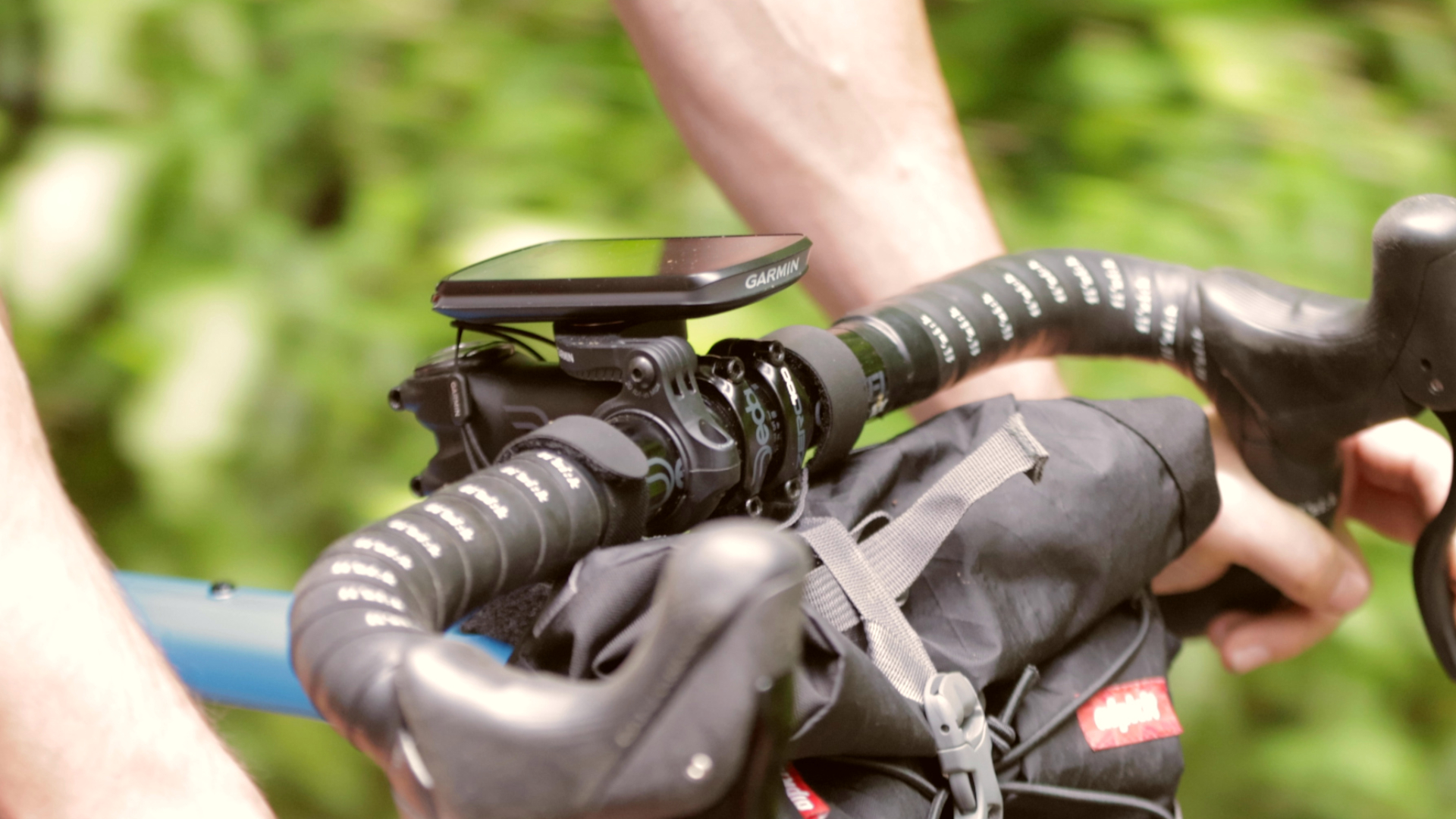
The Garmin Edge 1040 Solar is both multi-band and multi-GNSS
GPS vs GNSS: tracking and mapping
Even if you have a multi-GNSS and multi-frequency unit, that doesn't mean that your accuracy is going to be military grade.
“Remember when bike computers or data tracking watches first came out? You could spot the early adopters a mile off as they were standing still on a race start line trying to pick up a satellite signal,” says Garmin’s Rich Robinson.
“That was because you were literally waiting for a satellite to move into a position that you could receive a signal. Thankfully, on the more recent navigation devices that use more than one GNSS, it will be able to call upon any satellite system in order to receive the swiftest pick-up. If it is a GPS (which in all likelihood it will be due to its prevalence) and you have multi-band frequency too, you'll get the most accurate data.
“It used to be a thing that the more GNSS your receiver was able to process, the quicker your battery would drain. That's a real myth these days for 99.9% of the population, and it's more likely to be a bigger processor (which is busy turning the signal in to usable data) that has a bigger impact on the unit’s battery life.”
“The accuracy you get still depends on your mapping,” Robinson adds. “GPS likes straight lines. When it comes to plotting a route, unless you go plotting mad and put in a pin on every single bend or turn – which will make your device slower as it's storing all that information – you'll just get straight lines from when you last picked up a signal.
"This can be made even worse if your device is set in a power saving mode, tracking a signal every couple of minutes. You might find yourself wildly out of position, or if you are recording your route, over or under on distance or altitude.
"This isn't a huge issue on the open road, but in cities or off-road riding with lots of twists and turns, this can lead to you getting completely lost.
“The more processing power your device has, the more likely that it will use something called a SmartData algorithm that irons out straight lines into a more realistic route, especially if it’s been ridden before using the same platform, as it can use the information to get more accuracy from analysing multiple similar datasets and draw a more accurate picture.
"Of course, that level of information requires a lot of processing, up to 60 times that of a device that doesn't have the same accuracy, which is super-power hungry. This is why batteries need to be so good these days, just to support the technology that is available.”
Why can’t I get a decent satellite signal?
You've got the multi-GNSS multi-band, SmartData tracking, huge processor and immense battery reserves but you still can't pick up a signal. What's up with that?
"Assuming your all-singing receiving device is actually working properly, and you are in the northern hemisphere there’s really only signal-jamming that would impact on consumers" says Thomas of the UK Space Agency.
“Never say never in regards to the owner of a satellite system suddenly not allowing consumers to use its network, but on the bases that no classified information will ever be used on that system, there’s no reason to switch off broadcasting.
“If you find yourself in certain vicinities, and there seems to be a blanket no signal, you may find that it's high level, military signal jamming,. This is high power and will create a signal black hole for miles around. It’s highly unlikely that it will impact your regular bike computer or fitness trainer, but it can happen.
Here at Cycling Weekly, we were easily able to find when GPS jamming exercises were taking place, so worth checking in advance if you are planning a ride need military bases.
Thomas reassures us that "there certainly isn't a cause for concern that you are being tracked by a satellite system operator – no one at that level wants to know where you are riding your bike.
"Someone's boss, on the other had might. Although illegal in most countries, privacy jammers that block satellite signals can block the signal for your receiver too. They are used to shield location detectors that are often fitted to work vans, so if you scratching your head wondering why you can’t get a signal on a good day in open terrain, check you’re not standing next to a white trades van, especially if the driver is having a nap.
“Unfortunately similar systems are becoming more popular in vehicle theft, with the culprits fixing a GNSS signal jammer to a stolen car, abandoning it while it's still hot, before returning to it a few days later. Again, if you are in a signal black hole, this could be why.”

Thank you for reading 20 articles this month* Join now for unlimited access
Enjoy your first month for just £1 / $1 / €1
*Read 5 free articles per month without a subscription

Join now for unlimited access
Try first month for just £1 / $1 / €1
Hannah is Cycling Weekly’s longest-serving tech writer, having started with the magazine back in 2011. She has covered all things technical for both print and digital over multiple seasons representing CW at spring Classics, and Grand Tours and all races in between.
Hannah was a successful road and track racer herself, competing in UCI races all over Europe as well as in China, Pakistan and New Zealand.
For fun, she's ridden LEJOG unaided, a lap of Majorca in a day, won a 24-hour mountain bike race and tackled famous mountain passes in the French Alps, Pyrenees, Dolomites and Himalayas.
She lives just outside the Peak District National Park near Manchester UK with her partner, daughter and a small but beautifully formed bike collection.
-
 Man hands himself in to Belgian police after throwing full water bottle at Mathieu van der Poel during Paris-Roubaix
30-year-old was on Templeuve-en-Pévèle cobbled sector when television pictures showed the bottle hitting him in the face
By Tom Thewlis Published
-
 Fizik Vento Omna Wide shoe review: Yeti sneakers for those pedalling on a budget
Broadly recommended for those of us with flipper feet
By Simon Fellows Published